Turks and Caicos Beaches Map 2026: Your Mental GPS
A Turks and Caicos beaches map is useless unless you understand that the island of Providenciales has four distinct geographic personalities. The side of the island you choose defines your entire trip.
Picking a resort on Long Bay Beach and expecting the calm, turquoise lagoon of Grace Bay is the most expensive mistake a first-timer makes. The wind and sargassum patterns enforce a strict spatial logic.
This guide builds a mental map of the island. I will tell you exactly which specific strip of sand belongs to which type of traveler in 2026.
Turks and Caicos Beaches Map: The Four-Sided Island Logic
The Providenciales beach map is a simple compass-driven framework you must memorize. The north shore is the famous barrier-reef-protected luxury strip.
The east side is the windward coast, a wild and often seaweed-heavy kiteboarding frontier. The south shore is a hidden collection of calm, shallow, family-friendly coves.
The far west is the remote, undeveloped tip where the road ends. Each compass point delivers a completely different water color, sand texture, and vacation vibe.
The Turks and Caicos Islands Government legally mandates free public access to all beaches. The crown land access paths are your key to exploring beyond your resort’s walls.
A rental car is not a suggestion. It is an essential tool to navigate the Leeward Highway and the Grace Bay Road, which form the island’s central spine.
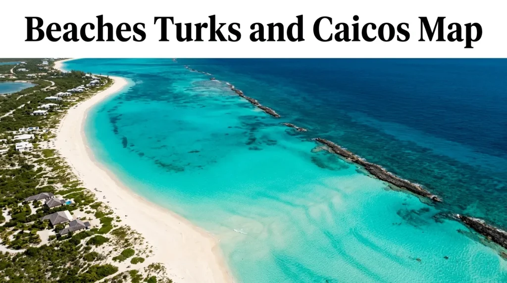
The barrier reef sits about a mile offshore on the north side. This natural wall is the island’s most important infrastructure, creating the calm, swimmable lagoon.
Key Takeaway: North is for luxury swimming. East is for wind sports. South is for toddlers. West is for solitude.
Map of Turks and Caicos Beaches: Providenciales in Zones
A practical map of Turks and Caicos beaches is a zoning tool for your hotel search. The 12-mile island breaks down into distinct resort neighborhoods.
The Grace Bay strip is the central, expensive heart. It runs from the Wymara Resort in the west to Leeward Going Through in the east.
The Leeward zone is the eastern extension of Grace Bay, home to the ultra-exclusive Rock House resort. This is the quietest, most private part of the main strip.
The Long Bay Hills zone is a completely separate world on the southeastern coast. The water here is shallow, choppy, and deep blue, famous for kiteboarding.
The Sapodilla Bay and Taylor Bay zone in the southwest feels like a different island. These are natural, bathtub-calm, shallow lagoons with no resort walls in sight.
The Bight, or “Bight Beach,” is a secondary calm-water zone next to the marina. The famous Beaches Turks & Caicos resort dominates this section of the map.
Understanding the map of beaches means understanding that the most expensive-looking Airbnb photo might be on a sargassum-plagued shore. The map tells the truth the listing hides.
Key Takeaway: The Grace Bay Road is your zonal boundary. Resorts on the beach side are premium; villas on the inland side require a short walk or drive to the sand.
Beaches Turks and Caicos Map: Navigating the Main Strip
The Grace Bay Beach map is the only visual that matters to 90% of first-time visitors. It is a 12-mile crescent of powder-white sand, but the experience is not uniform.
The central Grace Bay zone, between The Palms and the Grace Bay Club, is the most crowded and amenity-rich. This is the walkable “downtown” of the beach.
The western Grace Bay zone, near the Wymara Resort, has wider sand and fewer crowds. The water color here is the most electric, shallow turquoise on the island.
The eastern end of the strip transitions into Leeward Beach. The sand here is narrower, but the privacy is supreme, and the water remains the same calm lagoon.
Bight Reef, near the Coral Gardens hotel, is the top snorkeling spot on the map. The marked underwater trail is a free, public marine park teeming with turtles.
The access map is straightforward. The main Grace Bay Road runs parallel to the sand, with small, sandy public access paths squeezed between the resorts.
A traveler seeking silence should walk east. A traveler seeking service and a beach bar should set up near the central resort zone.
Insider Tip: The “Smith’s Reef” area near Turtle Cove is the local’s snorkeling spot. The map often misses it, but the coral heads here are more vibrant than Bight Reef.
Key Takeaway: Central Grace Bay is for service and social energy. Western Grace Bay and Leeward are for a quieter, more exclusive sand experience.
Map of Beaches Turks and Caicos: The Southern and Western Secrets
The southern and western points of the Providenciales map hold the beaches that make you feel like a mapmaking explorer. These coves have no high-rise hotels.
Sapodilla Bay is a protected, shallow cove in the southwest. The water is a mirror-like, calm sheet of turquoise that rarely reaches a depth above four feet for a hundred yards.
A small hill behind the beach provides the single best panoramic photograph in the country. You can see the entire Caicos Banks from this vantage point.
Taylor Bay, a short walk from Sapodilla, is a hidden sandy basin. The water here is so shallow at low tide that it creates a natural wading pool perfect for toddlers.
The limitation of this southern zone is the lack of services. There are no luxury hotel restaurants or swim-up bars here, just one or two local vendors.
Malcolm’s Road Beach at the far northwestern tip is the final frontier on the map. The road to get here is a long, unpaved track through a remote coastal reserve.
The reward for the drive is a wild, dramatic beach where the barrier reef ends. The snorkeling on the far western wall is for experts only, with a strong current.
A family should dedicate one full day to the Sapodilla/Taylor Bay zone. Pack a cooler, rent a car, and drive southwest for a beach day you will not forget.
Key Takeaway: Sapodilla Bay and Taylor Bay are the best beaches on the map for a family with young children. No waves, no crowds, no resort fees.
Turks and Caicos Beach Geography Explained
Turks and Caicos beach geography is a study in the trade winds. The consistent easterly wind is the invisible architect of every beach experience.
The north-facing Grace Bay is the leeward shore. The wind blows from the land out to the reef, keeping the water flat and crystal-clear.
The east-facing Long Bay is the windward shore. The consistent onshore wind creates the choppy, kite-surfing water that is terrible for swimming but perfect for adrenaline.
The south-facing coves are protected from the prevailing wind by the landmass itself. This is why Sapodilla Bay is glassy calm while Long Bay, just a few miles away, is a wind tunnel.
The Caicos Banks, the shallow turquoise shelf visible on any satellite map, is the island’s defining geographic feature. This 4,000-square-mile platform is why the water is so impossibly colored.
The depth of the water changes the color on the map. The deep Atlantic ink blue is on the north shore beyond the reef. The electric neon turquoise is the shallow bank.
A traveler who understands this geography will never waste money on a Long Bay villa in July. They will use the wind map to their advantage.
The Caribbean Tourism Organization reports that Turks and Caicos’ consistent wind and flat water on the Banks side are what separates it from the more mountainous, wave-prone islands like St. Lucia.
Key Takeaway: The trade winds blow from the east. Book a north or south shore beach for calm water.
Beaches Turks Map: Understanding the Beaches Resort Location
The search term “beaches turks map” often means the traveler is looking for the location of the all-inclusive Beaches Turks & Caicos mega-resort. It occupies its own distinct zone.
The Beaches resort is not on Grace Bay proper. It sits on a beautiful, calm stretch of sand in the Bight, a few miles west of the main Grace Bay hotel strip.
The water in the Bight is a shallow, bright-turquoise lagoon. It is exceptionally calm and safe for children, which is precisely why the family-focused Beaches resort is here.
The resort is a self-contained village. Four themed villages, a water park, and a dozen restaurants mean a family staying here hardly needs the rest of the map.
The limitation of the Beaches location for a couple without kids is the atmosphere. The resort is loud, high-energy, and designed entirely around multi-generational family entertainment.
The nearby Bight Park is the Thursday night fish fry location. Even if you are not staying at the resort, this area is worth mapping for the cultural experience.
The Coral Reef Resort is a quieter, adult-friendly alternative nearby. It sits on the same excellent stretch of sand but with a fraction of the crowd and noise.
A common map-based mistake is booking a “Grace Bay” hotel near Beaches and expecting a quiet romantic vibe. The Bight zone is a family-first, high-energy corner of the coast.
Key Takeaway: The Beaches resort is in the Bight, on its own excellent family lagoon. The main Grace Bay luxury strip starts a few miles east.
Beaches Turks and Caicos Resort Map: Resort-by-Resort Zones
A Turks and Caicos beaches resort map matches the property to the precise sand character. The wrong resort on the right island is still a vacation mistake.
| Resort | Map Zone | Best For | Honest Beach Limitation |
|---|---|---|---|
| Wymara Resort | Western Grace Bay | Trendy couples, design lovers | The beach here is perfect, but the hotel pool is small for the size of the resort. |
| Grace Bay Club | Central Grace Bay | Classic luxury, families with teens | The central sand can feel crowded during peak season. |
| Rock House | Leeward | Honeymooners, ultimate privacy | The beach is narrow, and you are a drive from the central restaurants. |
| The Shore Club | Long Bay | Kiteboarders, luxury spa seekers | The water here is often too rough and weedy for casual swimming. |
| Beaches Turks & Caicos | The Bight | Young families, multi-gen groups | The beach is calm but can feel busy with the sheer number of resort guests. |
| The Ritz-Carlton | Eastern Grace Bay | High-end service, casino access | The eastern Grace Bay location is quieter, with less foot traffic. |
The luxury traveler’s sweet spot on the resort map is the western Grace Bay zone. The Wymara and the nearby Villa Renaissance offer the finest sand with the fewest people.
The Point Grace boutique hotel on central Grace Bay is the romantic dark horse. This small, traditionally styled property sits on the widest section of the central beach.
A resort map study reveals a simple truth. The most expensive resort is not always on the best beach, but the Wymara and Grace Bay Club sit on the prime central-western sand.
Key Takeaway: The Wymara zone and the Point Grace zone represent the two best beach-to-resort matches on the Grace Bay map.
Grace Bay Beach Map and Zones: West, Central, and East
The Grace Bay Beach map is a study in three distinct zones. The sand is the same powder white, but the vibe and the width shift as you walk east.
The Central Zone, from the Saltmills Plaza to the Regent Grand, is the social hub. The beach is wide, the water is calm, and the resort beach chairs form a continuous line.
The Western Zone, from the Wymara to the Gansevoort, is the escape. The sand here is even wider, and the resorts are spaced further apart, creating a more private feel.
The water color in the western zone is the most spectacular on the island. The shallow Caicos Banks creates a neon turquoise that is deeper and richer here than on the central beach.
The Eastern Zone and Leeward area are the tranquil, low-traffic end. The beach narrows in places, but the privacy increases dramatically.
The eastern zone’s limitation is the proximity to the Leeward channel. The water can have a subtle, natural tidal flow near the cut that swimmers should be aware of.
The Princess Alexandra National Park designation covers the entire Grace Bay marine area. This protection is why the reef is healthy and the sea turtles are so common.
A honeymooner should map their days to the western zone. A family who wants easy access to restaurants should map to the central zone.
Insider Tip: The section of sand directly in front of the Sibonné Beach Hotel on central Grace Bay is the widest, most publicly accessible patch of sand on the strip.
Leeward Beach Map and Access: The Quiet Eastern End
Leeward Beach on the map is the easternmost segment of the main Providenciales north shore. It begins where the Grace Bay resort strip ends.
This is the beach for the traveler who wants the same Grace Bay water without the resort density. The sand is a continuous ribbon of calm perfection.
Access to Leeward is through the Leeward Going Through neighborhood. The public access paths are narrow, unmarked sandy trails between multi-million dollar private villas.
The new Rock House resort is the only major hotel on this stretch. It has brought a boutique, cliffside Mediterranean energy to this previously villa-only zone.
The limitation of Leeward for the swimmer is the subtle current. The proximity to the channel means the water is less of a glassy bathtub and has a bit more natural movement.
The advantage for the snorkeler is the untouched reef. The coral heads off Leeward are less trafficked than the central Bight Reef zone.
A couple renting a villa in Leeward should map out their grocery and restaurant runs in advance. The drive to the Grace Bay central zone for dinner takes 15 minutes.
Forbes Travel Guide has recently highlighted Rock House as the most architecturally distinct new property, raising the profile of this quiet, eastern map zone.
Key Takeaway: Leeward Beach is the map zone for the traveler who wants a villa, a private strip of sand, and zero interaction with a resort pool crowd.
Long Bay Beach Turks Map and Kiteboarding
Long Bay Beach on the southeastern coast is the kiteboarding capital of the island. If the wind is your sport, this is the only part of the map that matters.
The water here is a shallow, choppy, deep-blue square mile. The consistent onshore trade winds create a world-class, flat-water freestyle playground.
The beach is backed by the Shore Club, the Long Bay resort that caters to a luxury-seeking kiteboarding crowd. The spa here is the post-kiting recovery zone.
A non-kiteboarding swimmer should not book a hotel on Long Bay. The wind and the choppy water are relentless, and the sargassum seaweed is at its worst here.
The sargassum map of Turks and Caicos is centered on this eastern shore. From May through August, the windward beaches can be piled with rotting brown seaweed.
The kiteboarding schools along Long Bay are professional and well-established. A beginner can take a lesson on the shallow, waist-deep water and learn in a safe, flat environment.
The Turks and Caicos Kiteboarding Association monitors the wind conditions and the beach access points. This coast is a dedicated sports zone, not a beach-lounger’s paradise.
A solo traveler who is a keen kiteboarder should map their entire trip to this zone. Stay at an Airbnb or a small villa, kite three times a day, and drive to Grace Bay for dinner.
Key Takeaway: Long Bay on the map is for kiteboarders only. The sargassum and wind ruin it for casual swimming from May onwards.
Sapodilla Bay and Taylor Bay Map for Families
The southwest corner of the Providenciales map holds the two greatest family beaches on the island. Sapodilla Bay and Taylor Bay are natural, shallow-water sanctuaries.
Sapodilla Bay is a protected, crescent-shaped cove. The water depth increases so gradually that a toddler can walk out fifty feet and still touch the sandy bottom.
The access to Sapodilla is via a residential neighborhood in Chalk Sound. There is no resort, no formal parking lot, and no commercial development, just a sandy path.
Taylor Bay, a few minutes walk to the west, is even more hidden. This is a vast, shallow tidal basin that feels like a private, natural infinity pool.
The sand at Taylor Bay is impossibly soft, white silt. The shallow water heats up quickly in the sun, creating a bath-like temperature that small children adore.
The honest limitation of this family map zone is the lack of facilities. A family must pack every single item they need, from sunshade to snacks.
A luxury traveler will find no five-star hotel here. The trade-off for the pristine, undeveloped beauty is a total absence of service staff and catered lunches.
The Chalk Sound National Park, visible on the map just inland from Sapodilla, is a surreal, electric-turquoise lagoon dotted with small rocky islands. It is an essential family photo stop.
Key Takeaway: Sapodilla and Taylor Bay are the safest, most beautiful swimming holes on the map for a young family. Come prepared and stay for the day.
Providenciales Beach Access Points Map
Every beach in Turks and Caicos is public up to the high tide line. The Providenciales beach access points are the legally mandated footpaths that make this public right a reality.
The public access points are narrow, sandy lanes between the walls of oceanfront resorts. They are intentionally discreet and easy to miss if you are not looking for them.
The most important access point for a visitor without a resort wristband is the path at the Regent Grand. This provides access to the widest central Grace Bay sand.
The access path next to the Hemingway’s Restaurant is the best entry to the calm, vibrant water in the western zone. It offers a free alternative to the resort-chair setup.
The access points are a brilliant way to beach-hop by car. Park on the side of Grace Bay Road, walk through a 30-second sandy path, and emerge onto a perfect beach.
A common frustration is the lack of formal parking lots at these public access points. The legal requirement is for a footpath, not a car park.
The Turks and Caicos National Trust maintains the access to more remote, environmentally protected beaches like Malcolm’s Road. These are marked on official paper maps.
A budget traveler armed with a rental car and a map of the access points can experience the exact same sand as a $2,000-a-night resort guest. The public paths are the great equalizer.
Key Takeaway: The Regent Grand access path and the Hemingway’s path are the two most valuable public entries on the Grace Bay map.
Best Beach on the Map for Couples
The best beach on the Providenciales map for a couple seeking romance is the quiet, exclusive western end of Grace Bay. The sand is wide, the water is electric, and the crowds vanish.
The stretch of sand directly in front of the Wymara Resort is the couple’s sweet spot. The hotel’s beach service is impeccable, and the private cabanas create a romantic cocoon.
For a completely private, off-the-map couple’s experience, the destination is Malcolm’s Road Beach. The drive is long, but the reward is a wild, deserted cove.
A couple should pack a picnic and a bottle of champagne for Malcolm’s Road. The silence here, broken only by the sound of the reef, is the definition of romantic isolation.
Taylor Bay at sunset is the secret romantic map pin. The shallow, mirror-flat water reflects the pastel sky, and the lack of people creates a profound sense of private beauty.
The Coco Bistro restaurant, set in a palm grove near central Grace Bay, is the romantic dinner map pin. The twinkling lights in the palm canopy are iconic.
A honeymoon couple should map their entire trip around one zone: the western Grace Bay to Leeward corridor. Stay at the Wymara or Rock House and experience the best of the island.
The Grace Bay Club’s Infiniti Restaurant offers a romantic dinner directly on the sand. The wooden deck, the torches, and the sound of the still lagoon define a couple’s night.
Key Takeaway: The western Grace Bay zone, from Wymara to Point Grace, is the most consistently romantic couple’s corridor on the map.
Turks and Caicos Sargassum Map 2026
The 2026 sargassum seaweed map of Turks and Caicos is governed by the wind. The brown macroalgae accumulates on the windward shores that face the prevailing easterly breeze.
The most heavily affected zone on the map is the eastern and southeastern coast. Long Bay, in particular, can see significant accumulation from May through August.
The Grace Bay north shore is largely protected from sargassum by the barrier reef. The seaweed rarely makes it through the reef cut in significant amounts.
The south shore coves are also protected. Sapodilla and Taylor Bay remain almost entirely sargassum-free due to their westerly-facing orientation and protected bay geography.
The sargassum is not a toxic risk, but it smells like sulfur as it rots on the sand. A resort on Long Bay can be physically uncomfortable during a heavy bloom.
The 2026 forecast from the University of South Florida’s Optical Oceanography Lab suggests a continued trend of significant Atlantic sargassum blooms. The windward islands will be impacted.
The hotel industry response on Long Bay has been aggressive. The Shore Club employs a dedicated beach-cleaning team during the summer months.
A traveler who is deeply concerned about sargassum should book a hotel on the north shore Grace Bay strip or the south shore Sapodilla zone. Avoid the east coast from May to October.
Key Takeaway: The north and south shores are the safe sargassum-free zones. The east-facing Long Bay is the high-risk zone on the 2026 map.
Turks and Caicos Islands Map vs Beach Map
A standard Turks and Caicos islands map shows a scattering of cays. A beach map focuses almost entirely on the single island of Providenciales.
The islands map includes North Caicos, Middle Caicos, South Caicos, and the remote private resort islands like Parrot Cay. The beach map is 90% Provo.
Parrot Cay is the most famous off-island beach map pin. The exclusive COMO Parrot Cay resort is a private-island wellness retreat frequented by celebrities.
South Caicos is the emerging frontier on the 2026 map. The new Sailrock Resort has put this rugged, historically fishing-focused island on the luxury beach radar.
A traveler who studies the broader islands map can access a completely different experience. The ferry to North Caicos opens up the deserted beauty of Bottle Creek and Whitby Beach.
The honest limitation of leaving Provo is the logistical effort. The inter-island flights and ferries add a layer of time and cost that the all-in-one Provo map avoids.
The Turks and Caicos Islands Government is investing in the infrastructure on North and Middle Caicos for the 2026 season. The “other islands” map is slowly opening up.
The classic 2026 itinerary uses the Provo beach map for six days and the islands map for a single, adventurous day trip. Provo remains the accessible, amenity-rich heart of a beach holiday.
Key Takeaway: The Provo map is your daily beach tool. The islands map is your adventure day-trip into undeveloped, remote Caribbean beauty.
Safety and Seasonal Warnings for Turks and Caicos Beaches
The natural environment on the Turks and Caicos map presents two primary seasonal risks for 2026: the hurricane season and the sargassum season. These dictate the liveability of your chosen beach zone.
Key safety and seasonal facts every visitor should know:
- Hurricane season runs from June 1st to November 30th. August and September are the peak risk months. The entire island chain is in the Atlantic hurricane belt.
- Sargassum seaweed impacts the windward east coast from May through August. The smell and the barrier it creates to the water can ruin a beach day. Book a north or south shore beach.
- The sun is equatorial and unforgiving. The UV index is consistently extreme. A rash guard and high-SPF zinc sunscreen are non-negotiable gear.
- The Leeward Going Through channel current is deceptively strong. Do not swim across the channel cut where the lagoon water meets the open sea. Stay within the calm reef-protected water.
- Resort security patrols the Grace Bay strip. Petty theft from an unattended towel is the most common crime risk. Use the hotel safe and leave valuables in your room.
In a beach emergency, dial 911. The local police and the resort security teams have a fast response time on the Grace Bay tourist corridor.
Frequently Asked Questions About the Turks and Caicos Beaches Map
Where is Grace Bay Beach on the map of Turks and Caicos?
Grace Bay Beach is on the entire north shore of the island of Providenciales. It is a 12-mile continuous strip facing the barrier reef.
The central Grace Bay hotel zone is directly north of the Providenciales International Airport.
Is the Beaches resort on the best part of the beach?
The Beaches resort sits on a beautiful, calm section of beach in the Bight area. It is not on the main, central Grace Bay strip.
The water at the Bight is safe and clear, but the atmosphere is a high-energy family zone.
What side of Turks and Caicos has the calmest water?
The north shore Grace Bay side and the south shore Sapodilla Bay have the calmest water. The north shore is protected by a barrier reef.
The south shore coves are protected by the landmass from the easterly trade winds.
Are all beaches in Turks and Caicos public on the map?
Yes, all beaches are legally public up to the high tide line. The public access paths between resorts are the legal entry points.
There is no such thing as a private beach in Turks and Caicos, only private land leading to the public sand.
Where is the sargassum seaweed worst on the map?
The sargassum is worst on the eastern windward coast, specifically on Long Bay Beach. The seaweed accumulates here due to the onshore trade winds.
The north and south shore beaches are largely sargassum-free year-round.
Can you walk the whole beach in Turks and Caicos?
Yes, you can walk the entire 12-mile continuous length of Grace Bay Beach. The sand is a single uninterrupted ribbon.
Walking from the western end to the eastern Leeward tip takes several hours and is a spectacular day trek.
Your Personal Map of Paradise
The Turks and Caicos beach map is a cheat code for the perfect Caribbean vacation. The traveler who understands the north-south-east-west logic of Providenciales has already won.
The traveler who ignores the map and books a pretty Airbnb on a windward sargassum beach in July will spend the week driving to find the calm water they should have booked. The map is your budget’s best defense.
Your next action is to match your traveler profile to a specific zone. Couples should book the western Grace Bay or Leeward corridor, while families should anchor their plan around the Bight or Sapodilla Bay.
Resort pricing, the 2026 sargassum bloom forecast, and private beach access amenities change seasonally. Verify your resort’s exact beach service and the current seaweed report just before departure.
Print a map in your mind, rent a car to explore the access paths, and watch the north shore lagoon reveal a dozen impossible shades of blue. The map has shown you the way.